Something Worth Saving

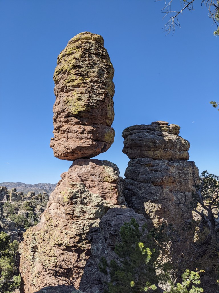
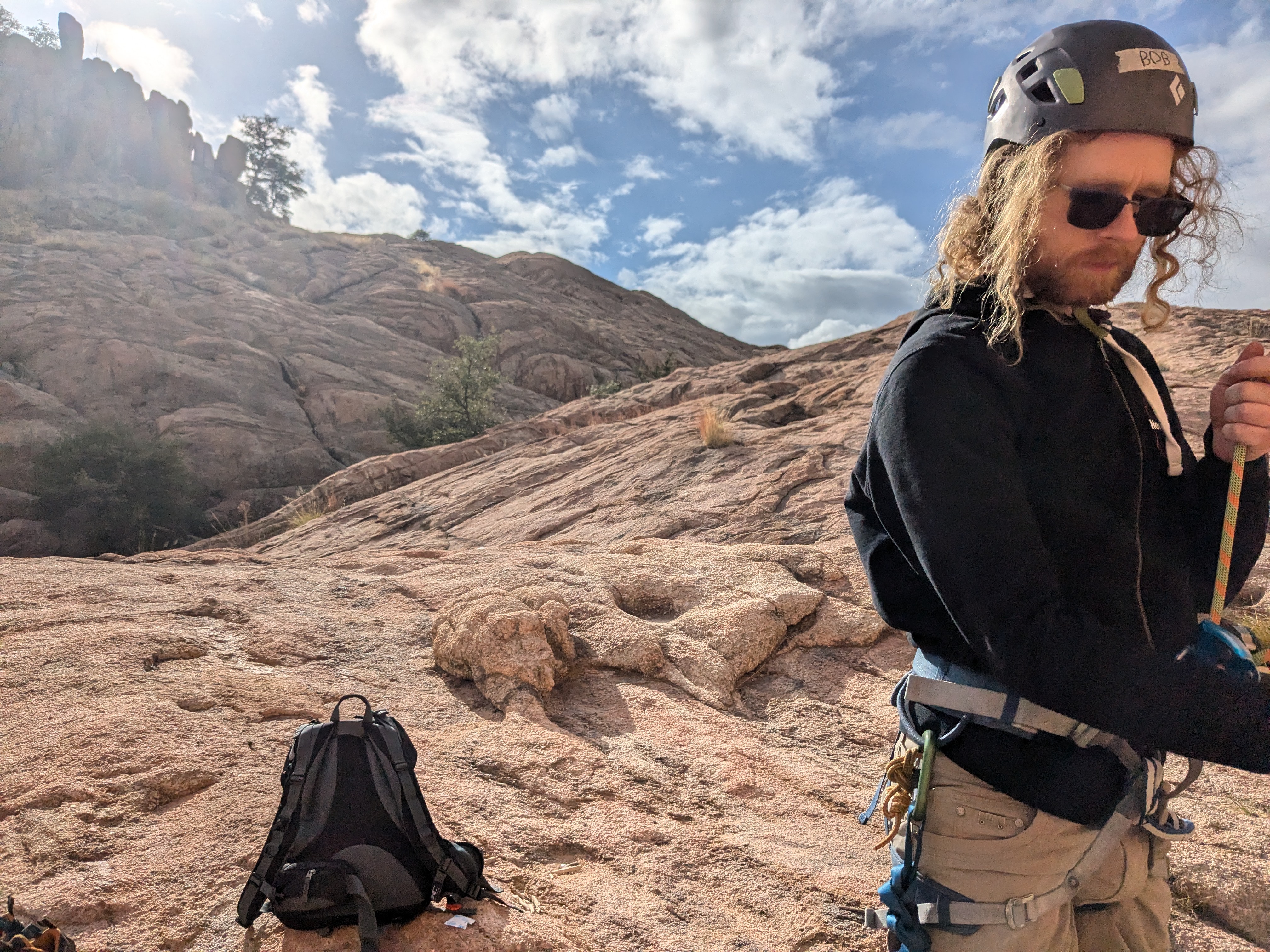
About a month ago, I traveled up north for the weekend to Prescott, Arizona, to do some mellow outdoor rock climbing and less mellow (below-freezing) camping with my partner Bob. I needed to be up there on Sunday because I was slated to volunteer with the Arizona Mountaineering Club for their outdoor school focused on building anchors. Anchors are meant to attach a climbing rope (or a climber) to a rock surface during rock climbing. The climbing rope is used as the climber’s lifeline, so learning how to ensure its safe placement and security is essential for climbing outdoors. 

A good climbing anchor follows the acronym ERNEST, which stands for Equalized, Redundant, No Extension, Solid and Timely. Equalized means all components of the anchor distribute the load equally, redundant means if one component fails there is a backup, no extension means there shouldn’t be any shock-loading at any point, solid means each component is strong enough to hold an impact on its own, and timely means it can be put together quickly if necessary.

I’ve volunteered as the Community Outreach Coordinator for a while with the Arizona Women’s Climbing Coalition, another local climbing organization. The organization aims to empower women and genderqueer people through rock climbing. My role is to help connect the organization and its members to different aspects of the rock climbing community, like other local climbing organizations, local businesses, and national non-profits and brands. One more recent example includes my efforts to join forces with the Arizona Mountaineering Club. We plan to partner on a stewardship project by providing funding and volunteers.

Earlier this year, we were preparing for an annual fundraising film festival, and I was contacting the owner of a local mountain guiding company for donations. Mac McCaleb runs Granite Mountain Guides, based in Prescott, Arizona, but also leads the local climbing organization Prescott Climbers Coalition (PCC). Mac generously donated to our cause, and through our interactions, I learned about the PCC’s role in protecting an area outside of Prescott that has many uses – including recreational rock climbing and climbing instruction. 

The campaign is called SaveSullivans and refers to Upper Sullivan’s Canyon, a significant land area because it is where the Verde River begins, right below the dam at Sullivan Lake. The Verde River is a tributary of the Salt River (which I wrote about here), and a portion of its 170 or so miles is protected through the National Wild and Scenic River program.

In the vicinity of Upper Sullivan’s Canyon, the area is designated as the Upper Verde River Conservation Opportunity Area (COA), by the Arizona Wildlife Conservation Strategy. The COA is a known Important Bird Area (IBA), comprising nearly 2000 acres of quality riparian habitat.

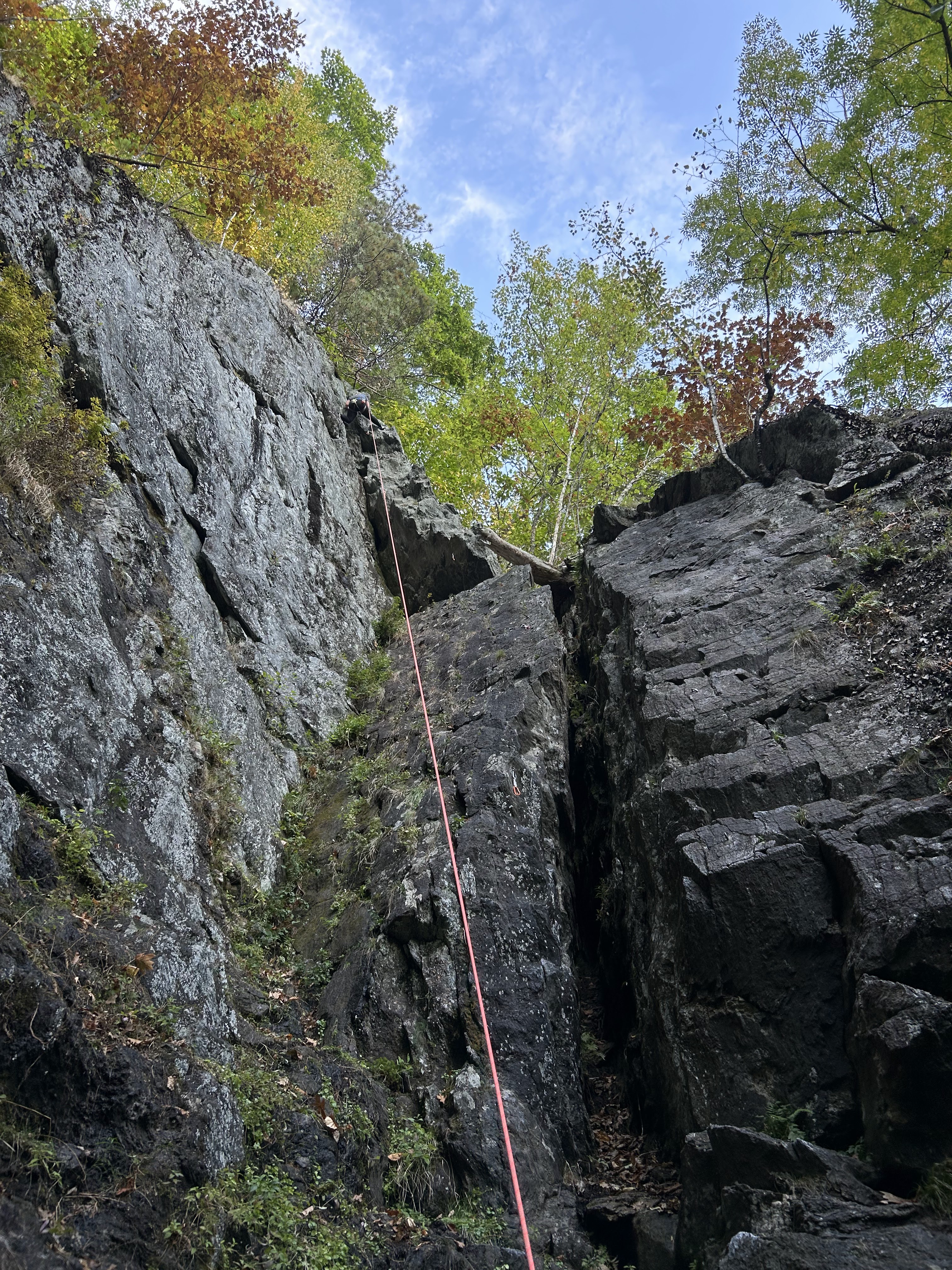
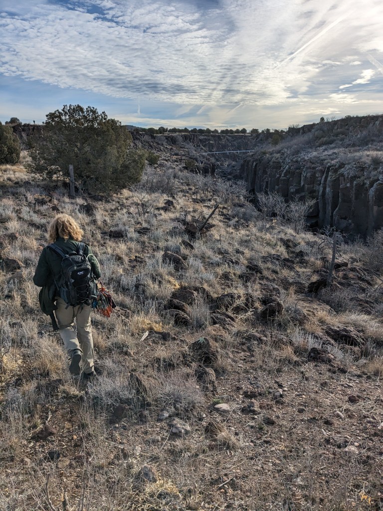
The land is also popular for outdoor recreation activities, including wildlife viewing, hiking, and – of course – rock climbing. My personal experience with rock climbing at Sullivan’s mainly includes its use as a natural “classroom” for rock climbing technique instruction through the Arizona Mountaineering Club (AMC). I have been involved with three courses there, once as a student and twice as an instructor, but the AMC has been using Sullivan’s to teach skills critical to the safe enjoyment of rock climbing in Arizona (and beyond) for decades. My last experience with the AMC occurred just one week following the celebration of the organization’s 60th “birthday.”

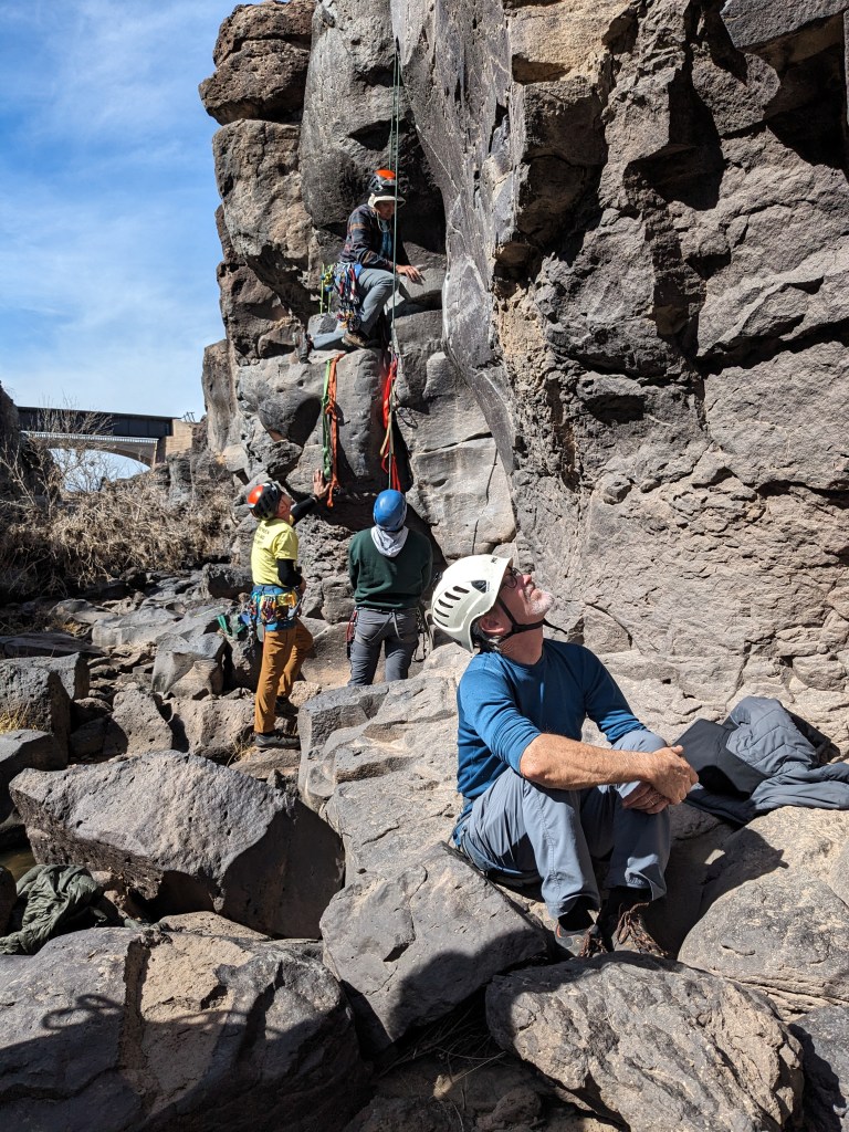
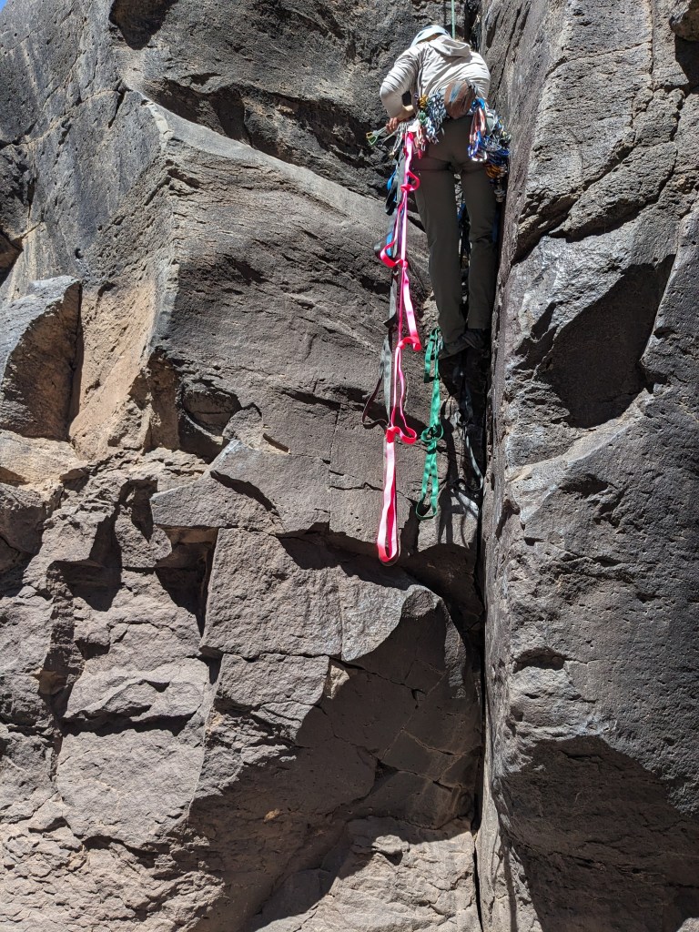
I’ve also tried climbing there – although the routes I attempted were quite tricky. The rock is something to be admired: it’s basalt, an extrusive igneous rock that is relatively young here – dated at only about 4.6 million years old! It is known as the Perkinsville Formation in this area. It consists of basalt flows from volcanic activity that followed the uplift of the Colorado Plateau – when deeply sourced material from a hot, upwelling mantle traveled upward through the crust, melting it and elevating it.


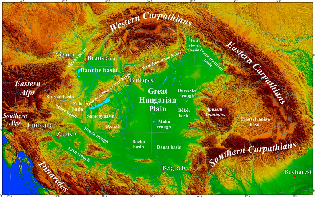
The physiographic region where Upper Sullivan’s Canyon is located is known as the “Transition Zone,” it denotes the boundary between the Colorado Plateau and the Basin and Range provinces. Therefore, geomorphic characteristics of both provinces are on display here, and the younger basaltic volcanism present in the area is likely due to late-stage, large-scale crustal extension associated with the formation of the Basin and Range. Much of the American Southwest was stretched about 12-8 million years ago, and subsequently faulted at a high angle, resulting in down-dropping basins filled with sediment adjacent to uplifted blocks forming the ranges.

What followed was a period that one of my colleagues likes to refer to as “Life After Faulting.” Landforms developed across the region as surface geomorphological features, like the Verde River, shaped the landscape. The section of the river that includes Upper Sullivan’s Canyon is a channel constricted by steep canyon walls due to the Verde River chewing downward into the uplifted landscape more recently (~2.5 million years ago).

Exposure of these basalt cliffs has led to the area’s popularity for rock climbing today. Still, ancient features like columnar jointing in the rocks (see featured image, image above, and image to the right), make that climbing experience inherently more interesting. This distinctive pattern of vertical hexagonal prisms is due to contraction during the cooling of the lava flows. Another distinctive feature is its vesicular texture, a “swiss cheese” pattern of void spaces that form due to gases escaping from solution in the lavas when it erupted. The bubbles never got the chance to pop before the lava solidified, trapping these little gas pockets for us to observe millions of years later.

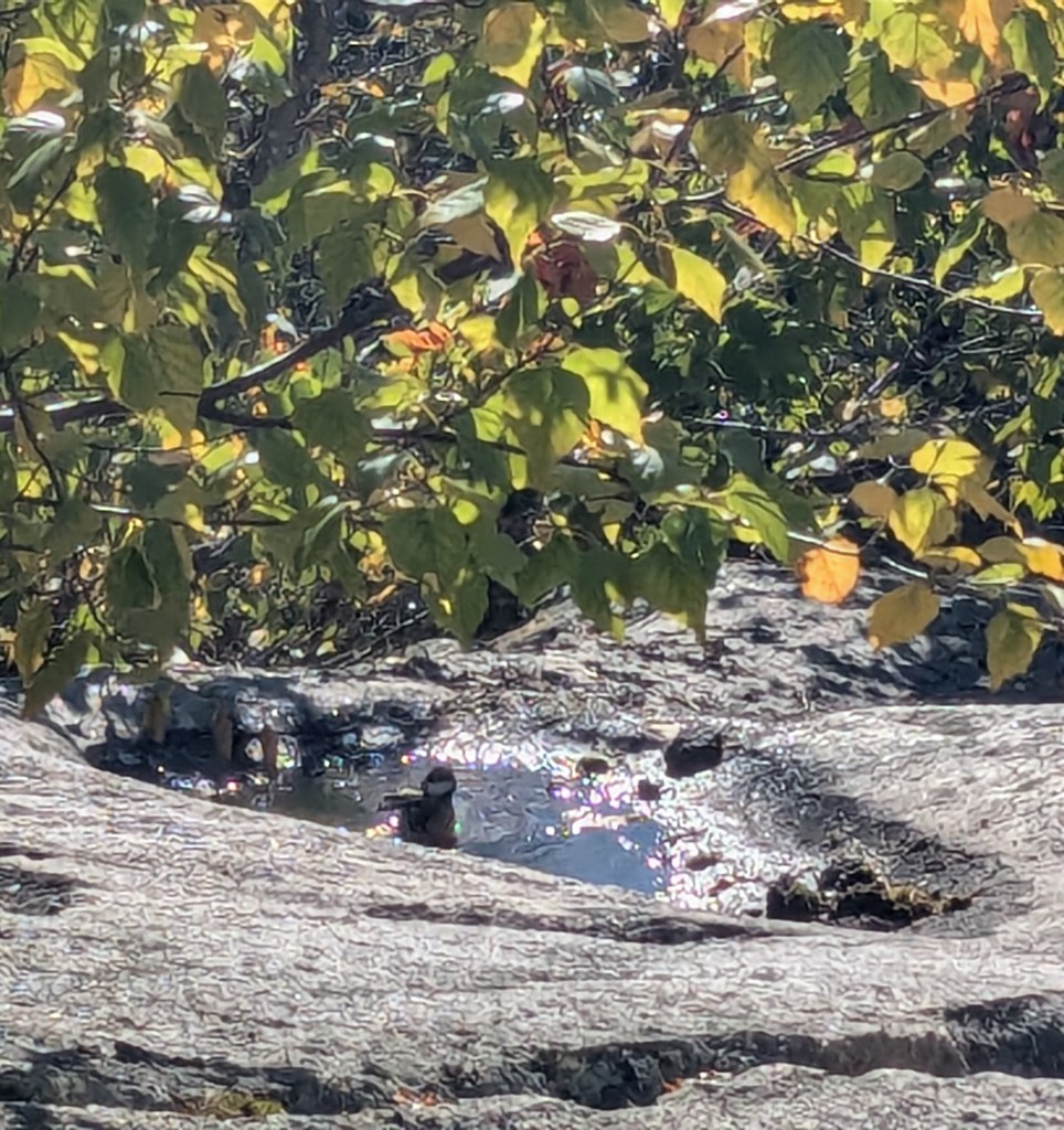
The geology of the Upper Verde River in and around Upper Sullivan’s Canyon has been found to impact the diversity of regional flora. Distinct species of plants correspond to different rock types. Of course, flora – in turn – impact the faunal diversity of the area, which includes “strategy species” of amphibians, birds, mammals, reptiles, and fish. One of my most pleasant experiences at Sullivan’s Canyon was observing a pair of majestic barn owls that seemed to be looking for a meal, perhaps rodents that indeed feed on the diverse vegetation there.

Beyond the ecological significance of Sullivan’s Canyon as a critical natural resource is its cultural and historical importance. Humans have found refuge here for a long time – as evidenced by petroglyphs and historical agricultural structures, including a few barns and a bunkhouse. I’ve only seen pictures of the petroglyphs, but I hope to learn more about them and find them on my next visit.


The SaveSullivans campaign is a worthy one. To preserve this critical natural resource – the “Gateway to the Upper Verde River” – is to ensure a flourishing ecosystem and secure the area for future generations. It is a place that combines the liberating power of nature and an intentional practice of keeping users educated and informed.

Donate here

Under Pressure

Last month, I spent a few days in New England. There’s something extraordinary about Fall in a place with four seasons – shortly after I returned to central Arizona, it finally dropped below triple digits!

I flew into Boston and spent a night in Cambridge because I was visiting with a friend from my teenage years/early adulthood who has been living there for a while now. I remember Katrina always wanted to end up in Boston, and I’m happy for her now that she’s successfully built a life there. We spent the evening near the MIT campus, stopping for ice cream at Toscanini’s before dinner because, according to Katrina, “Bostonians love their ice cream and have been reported to consume more of it per capita (especially in winter) than any other place in the United States”. Katrina ordered the goat cheese, honey, and pecan variety, which sounded really good, so I followed her lead. Delicious!

We walked around Cambridge, and Katrina shared facts about the local architecture and pointed out details I wouldn’t have otherwise noted. We walked around looking for a place to eat and landed at an all-you-can-eat hot pot establishment. It was very good, and we were very full. The next day, we walked over the bridge from Cambridge, and I ended up working remotely from a coffee shop on the Berklee College of Music campus – Boston has its share of higher education institutions, no doubt!

Some friends were joining me for the weekend in New Hampshire, the real purpose of the trip out East. We were to attend a rock climbing festival for women and genderqueer people called Flash Foxy Trad Fest in North Conway. We drove out to New Hampshire together and were to host a climbing meetup for the festival, but it had rained heavily the evening prior, and the rock was quite wet – too slippery for climbing on. Therefore, we decided to hike a short trail called Black Cap, and we saw a BLACK-CAPPED chickadee bathing in a puddle left from the previous night’s rain. 

Our plan for the following day was to spend the day doing something called sport climbing (funny, because the festival is called “Trad Fest”, which is a different style of climbing). In sport climbing, a leader uses fixed hardware in the rock to run a rope up the wall and protect other “followers” who wish to climb the same route. Diedre was the leader for all of the routes we climbed that day – an amazing feat and a serious demonstration of skill and courage.

We did several easier routes that day and one more moderate route – not that climbing grades (which denote relative difficulty) are important, or even objective. The “easier” routes were actually a good level of difficulty for me but the “harder” route was a little to much for me in my current state. I decided to bail prior to completing it because I had already made it past the crux – or hardest part of the climb – and I was so exhausted both mentally and physically. I knew it’d be better for my general well being to be able to put myself on more horizontally oriented ground.

I took a much needed break, talked with my mother <3, and enjoyed a short nap. I returned to the crag and finished the climbing day with an easy – but really fun – route called “Shealyn’s Way”. It features a lot of different climbing styles and the route is relatively long for a single pitch (as far as one can go with a 60 meter long climbing rope). I felt all of the uncertainty that I had built up within me from the more difficult climb completely wash away.

The rock we were climbing is called schist. It’s a rock that has been “metamorphosed” under elevated temperatures and pressures which causes changes to it’s crystalline structure. The minerals in the rock orient themselves as a response to the stress that is applied to them and you end up with a rock that records this story of undergoing change under pressure. It’s like when you push down on a ball of play-dough and it flattens into a new shape in response to the applied force.

Metamorphic rocks have always been my favorite of the three rock types (igneous, metamorphic and sedimentary). I think it’s because these rocks record their history of undergoing stressful situations. These “situations” often involve great forces and large-scale dynamism that for me is awe-inspiring and exciting to attempt to comprehend. That storied history literally changes them and that’s what – in my opinion, anyway – makes them beautiful and interesting.

So when I have a tough time climbing a hard route or when I doubt my ability to accomplish hard things, I remember that personal challenges transform me into something also more beautiful and interesting.

Into the Valley of Death

Death Valley does not sound like the name of a place I would want to venture into and yet it’s a place I’ve come to treasure. Death Valley, in eastern California is advertised as the “hottest, driest, and lowest” of the National Parks. It sits in the Mojave Desert and is a valley with mountain ranges on all sides. For example, on the west side there is the Panamint Range and on the east side there is the Amargosa Range.

Death Valley is interesting – geologically – because it is affected by a lot of different tectonic “regimes”. It is dynamically situated at the confluence of the Eastern California Shear Zone (which is associated with the Pacific-North America plate boundary); the Sierra Nevada (large suite of intrusive igneous rock that was subsequently uplifted and tilted); and the Basin and Range (extensional tectonic province spanning western North America).

I last visited Death Valley earlier this year – my brother is living in California and he was taking his first geology class. His school was also offering a field trip to Death Valley over Spring Break and my brother was so interested in his introductory geology course that he decided to attend the field trip, and he invited me!

I drove for a very long time to get there from my home near Phoenix. Arriving after dark, the course participants were all cleaning up following dinner so I set up my tent at the campground and hung out with my brother for a bit before going to sleep.

The next day we decided to explore on our own due to the fact that there were some places we wanted to check out that the course instructors weren’t planning to visit. The weather was also not great – it was actually quite rainy so the “driest” National Park was actually pretty wet. The valley was even filled with water – forming the now ephemeral Lake Manly (a rare occurrence). This was a remnant of the atmospheric river that affected southern California in the early months of 2024.

We had quite the adventure, and saw a TON of lovely geology, which I hope to share more about with you in some subsequent posts. For now I’ll just talk about our first stop, which consisted of a visit to Badwater Basin (and Lake Manly which filled it).

It was my second time at Badwater Basin. The first time I visited was in early March 2020 shortly before the onset of the COVID-19 pandemic. It was actually the last traveling I did prior to everything pretty much shutting down. I was working on a project in the Panamint Mountains that was fully remote so I wanted to visit in-person and get a better sense the geology. I went through Death Valley to get there and stopped at Badwater Basin along the way.

Badwater Basin is considered the lowest point in North America. Although, I met one geologist that argued against this – actually, a very important geologist – David Applegate, the incumbent director of the US Geological Survey. Anyway, the Basin reaches all the way down to 282 feet (85.5 meters) below mean sea level. It is a salt flat comprised mostly of sodium chloride (standard table salt) but also includes other evaporites (or sediments that form from evaporated solutions of water and dissolvable minerals).

The action of this hydration and evaporation of salts generates interesting polygonal geometries that are similar to cracks that form in a layer of dried out mud, for example. These cracks are very interesting in that their form (shape and size) are variable and dependent on things like the swell and shrink potential of the material (how much water it can hold), the rate of evaporation, and the temperature of evaporation.

Badwater Basin with salt polygons from March 2020.

Anyway, all of this makes for a very beautiful landscape when the ground is dried out. Of course, it wasn’t the second time I was there. The landscape was beautiful in a different way though – the flat, fairly still water reflected the surroundings like a foggy mirror. Simply surreal.

Lake Manly filling Badwater Basin, the water reflects the Panamint Range to the West.

Geology Mixtape

I’m old enough to have some experience (mostly during my early teenage years) making actual mixtapes… and as wild as it seems to me, you may not even know what that means, so I will go ahead and explain just in case.

Basically music portability used to occur via cassette tapes that consist of a magnetic tape that serves as an analog means of recording and playing back audio. The tape is wound around one spool and as it is read by the playback device the tape is collected on a second spool. I remember sometimes the tape would get pulled out of the plastic (or metal sometimes) cover and I’d have to use my pointer finger or the eraser end of wooden pencil to wind the tape back in – fun stuff!

Anyway, I would enjoy recording my favorite songs from the radio onto my cassette tapes so I could play them back when I pleased. I also curated different songs for themed “mixtapes” which I could gift to my friends and loved ones to share songs that I thought went well together. We now have digital playlists (on Spotify or whatever service you prefer) – which is pretty much the modern-day equivalent.

This process of arranging things – or organizing items into categories for a general purpose is something I’ve learned I excel at – I’m currently job-hunting so I recently took this assessment where you can discover your top strengths. One of mine is the “Arranger” which is described to me as “You can organize, but your flexibility complements this ability. You like to determine how all of the pieces and resources can be arranged for maximum productivity.” I think this trait transfers well to the creative realm and I started building my very own geology-themed musical playlist and I wanted to share that here.

In my opinion, it does not suffice to have a collection of songs just about rocks or geology or similar topics. In building my playlist I was looking for a specific “vibe”. I have to reach somewhat to try and describe it. Perhaps soothing or lightly upbeat sounds with some melancholy undertones. Maybe subtle notes with post-rock influences. Preferably performed by indie artists.

My motivation for this is inherently personal, as any good playlist typically is. Through the aging process, I’ve noticed a transition to a more relaxed state of being, and I think my musical taste reflects that. I also feel *lightly* upbeat a lot of the time (but not too upbeat; maybe merely content) and sometimes sad but pensive – not in a bad way though.

Stephanie’s Geology Mixtape

Drift – Galimatias and Alina Baraz

I chose this song because of the title – Drift. Continental drift was a concept that the early geological pioneer Alfred Wegener used to describe the motion of continental masses over long periods of time. The concept of continental drift was pivotal in the early development of plate tectonics theory. The song is about a feeling of passivity – specifically in a romantic way – but, it can be interpreted to represent loss of control.

Go Outside – Cults

I interpret this song to be about being held back by a loved one who is unwilling to experience growth. But, it’s called “Go Outside” and geologists spend a lot of time outside. I also think a big part of my pursuit of geology in the first place involved “go[ing] outside” of my comfort zone.

Through Me (The Flood) – Hozier

A flood is obviously a natural event that geologists care a lot about. It occurs when the capacity of body of water is exceeded – it results in what is typically dry land being inundated by water. In modern society, floods can be damaging and catastrophic. Hozier wrote this song during the COVID-19 pandemic when the world was being flooded with grief and loss; but, he also remarks on the strength of individuals to make their way through it.

After The Earthquake – Alvvays

This song describes a couple in a post-catastrophe scenario – they were arguing when one of them was suddenly injured in a car crash, putting the disagreement on hold. I often relate to how different experiences and events mold one’s perspective on things, especially life’s trials.

Alaska – Maggie Rogers

Alaska is just a place geographically, but – although it’s maybe a stretch – Alaska happens to be very geologically active. I like the song and add it to the list because Maggie Rogers sings about her reawakening following a difficult breakup. It reminds me how you can feel stuck in a difficult situation but then later experience something that makes you feel free again and perhaps even better than before.

SUPERBLOOM – MisterWives

More of an environmental science (or botanical) phenomenon, a superbloom occurs when an unusually high number of desert wildflowers blossom simultaneously, usually after heavy rainfall. This song resonates with me for several reasons, but I will suffice it to say that I currently live in the desert of Arizona, and leading up to that involved a lot of challenging experiences.

Meteorite – Anna Of The North

A meteorite is basically a space rock that “hits the ground alright” (it rhymes so its a good way to remember the difference between a meteorite and something that enters the atmosphere but burns up or otherwise doesn’t make it to the ground). This song is about a seemingly small encounter that has a large impact (pun definitely intended). It reminds me of times when I intentionally made small, manageable changes that later led to bigger, more meaningful ones.

Superposition – Young The Giant

Superposition is a concept that students typically learn about in introductory geology as “in undeformed columns of rock, the oldest is at the bottom and the youngest is at the top”. Its a concept of relative dating – or figuring out how old things are by comparing them to each other. I call it the “pancake concept” because when you make pancakes, you usually end up with the first one on the bottom and they pile up until last one ends up on top. The song is described by the artist to signify how in a realm of endless possibilities, one (superposed) outcome occurs.

Lava – Still Woozy

Lava is molten rock that has reached the planet’s surface. The song is about what I call a “volcanic” love. The artist describes his loved one in a way that renders high energy and explosivity – like a volcano. I know I can be a little hot-headed occasionally, so I hope that at least one person finds that endearing.

Landslide – Fleetwood Mac

This one is a classic, indeed. It encapsulates the concept of sudden catastrophic change – how everything a person has built in their life up to a point can all come crashing down, like a landslide. I went through a significant and tumultuous transformation midway through my doctoral studies, and during my healing process, I heard this song, which holds extraordinary meaning for me.

Five years in Arizona

This week marks the five-year anniversary of me moving to Arizona from Kentucky. I can’t believe it has been that long, it certainly hasn’t felt like it. But if I reflect back on what my life was like 5 years ago, versus what my life is like today – it couldn’t be more different. Not just the surficial things (different home, different partner, a second cat) but also the way I handle things in my life (better relationships with the people in my life and improved mental and physical health). I’m proud of who Arizona has turned me into and I’m truly happy with the transformation. Many days I think about how good things are and think they just couldn’t get any better, and then as time goes on things do just keep getting better and it blows my mind.

On my way out to Arizona though, I stopped in a lot of places and did some geologizing. I documented my experiences with the intention of one day writing about them in this blog. Well, I guess five years later, here we are…

The first place I stopped was the National Corvette Museum in Bowling Green, Kentucky. You might be thinking what does that have to do with geology? It turns out, in 2014, the National Corvette Museum was partially destroyed by a sinkhole which opened under the floor of the Skydome area of the museum. As a result, 8 Corvettes fell into the sinkhole along with the collapsed portion of the building.

In case you didn’t know, there’s A LOT of limestone in Kentucky (it contributes to many things about Kentucky like the quality of the bourbon, making it an ideal place to raise horses, and the bluegrass itself). Limestone is a rock composed primarily of calcium carbonate, which dissolves in groundwater. This results in void spaces underground that grow and grow until the space gets so large that there’s not enough support for the land above the spaces and the surface of the land collapses.

The primary bedrock formation on which the Corvette Museum was built is known as the Ste. Genevieve Limestone (sometimes combined with the St. Louis Limestone). That first link is to the geologic map copied below. You can see that most of the map is colored blue, which the key tells us is the Upper Mississippian Ste. Genevieve Limestone. The Upper Mississippian (Visian) spanned from about 350 to 330 million years ago.

During this time, much of North America, including present-day Kentucky, was under water. It was also south of the equator. The conditions were favorable for the deposition of carbonate rocks like the limestone members mentioned previously. That is, in shallow marine environments relatively close to the equator. These limestones contain fossils, including rugose corals in the St. Louis member. Rugose corals (sometimes called “horn corals”) are extinct today but were common from about 460 million years ago until the end of the Permian (about 250 million years ago) when the largest mass extinction in Earth’s history occurred.

So, whether you stop by the National Corvette Museum for the cars or for the karst (landscape underlain by limestone), there will be something interesting to see!

Connecting the seemingly unconnected

About a year ago, my grandmother was on her death bed and some of my family got together at my uncle’s house in San Diego, CA, where my grandmother had been living since my grandfather passed away. During this somber time, my cousins and I found solace in thumbing through my grandmother’s photo albums that she created over the years of her life. Within them we found letters, postcards, brochures and tickets from her and my grandfather’s travel, and – of course – photos of all of us as small children. It was bittersweet: the photos captured found memories of our youth, but we also reflected on the loss of innocence that occurs with age.

I realized that there was something about holding the albums full of photos and various artifacts lost in today’s digital world. I decided I wanted to follow after my grandmother and start scrapbooking my life’s events, a sort of “analog” version of social media that has become such an integral part of most of our lives.

Taking things back in this way has helped me realize some things, like how I have a certain type of creativity that I don’t always get to explore – by making something just for the sake of making it – or how one terrible photo can jog a memory of a significant event just as well as (if not better than) ten beautiful ones. I find it as a way to do something useful with all of the personal artifacts I’ve been collecting over the years and in turn, reduce my clutter. I’ve also lovingly shared stories and memories with friends and family as they look through my creations.

Anyway, last weekend I was scrapbooking a trip to Europe I took last summer and I thought I’d write about it here.

In Late August 2022, I attended a workshop in Hévíz, Hungary called the Ada Lovelace Workshop on Modeling Mantle and Lithosphere Dynamics. The meeting’s namesake, Ada Lovelace, is commonly credited with being the first computer scientist because she recognized the potential for mechanical analytical machines beyond pure calculation and was to come up with what would later be considered the first computer program.

The Workshop, named in honor of Lovelace in 2020, is held every two years in different locations throughout Europe and last year it was held in the town of Hévíz, Hungary. This location is known for thermal Lake Hévíz – the second largest “thermal lake” in the world and the largest one with temperatures suitable for swimming.

What makes Lake Hévíz a thermal lake? Hungary is situated in an area known as the Pannonian Basin. This basin resulted after smaller continental fragments collided with the European continent. Starting at about 17.5 million years ago and continuing for about 10 million years – during the middle-to-late Miocene – basins formed behind the Carpathian Mountains as the continental crust extended up to 100 km in an East-West direction. The depth of this extension varied with distance from the Carpathian Mountain range.

Digital terrain model of the Pannonian Basin and surrounding area [source].

Researchers posit that southward (and eastward) migration of the extensional zone occurred and the most internally situated portions of the basin were associated with the greatest depths. That is, the inner basin formed from extension of the entire lithosphere (the crust and uppermost mantle)!

Image Source

When the lithosphere extends in this way, it is thinned out and the deeper, hotter mantle “domes” and becomes situated closer to the surface. Even stranger is that lithosphere of the Pannonian Basin is about two times hotter than would be expected from these types of extensional processes alone. The paper cited attributes this extra thermal energy to “unknown processes in the lower lithosphere”. A more recent paper suggests that the higher modern temperatures are due to the fact that sediments that subsequently filled the basin are good insulators of the hot rocks at the base of the basin. In other words, cooling due to exposure at the surface has been significantly slowed. This has resulted in geothermal gradients (increases in temperature with depth) of up to 50°C/km in the uppermost 5 km of the crust. That’s about two times the global average.

What I found most interesting while looking up the geology of the Pannonian Basin was the tectonics that resulted in its formation. The tectonics of this area is related to the overall mountain building period associated with the formation of the Alps: The Alpine Orogeny. The Alpine Orogeny is linked to the Himalayan-Tibetan Orogeny (the mountain building period resulting in the formation of the Himalayan Mountains and the Tibetan Plateau). They are associated because they began around the same time and resulted in the closure of an ancient ocean known as the Tethys Ocean. Further, there are similarities in the respect that there are large-scale extensional features that form in a dominantly convergent setting. The discovery of this for the Himalayan system was groundbreaking, and actually involved my PhD dissertation advisor.

I think that has influenced what I find interesting and important when learning about the geology of new places. I often link what I find to what I’ve become most familiar with during my studies. I’ve written it before here, but I’ll say it again: “the best geologist is the one who has seen the most rocks”. Because I think it’s human nature to relate what one has experienced in the past to what one is experiencing for the first time.

The power to connect the seemingly unconnected.

William Plomer

The writer William Plomer described creativity as “the power to connect the seemingly unconnected.” If it is in fact very human to relate past experiences to new ones, everyone is creative and whether it be scrapbooking a trip I took almost a year ago, learning about the geology of a new place and connecting it to something I’ve spent years learning about, looking at spreadsheets full of model-derived data trying to see if any patterns develop, or even writing this blog: I get to be creative every single day.

Creativity is exactly what science is to me. As I learn more about geology, I learn more about the ways in which different physical systems that contribute to shaping our planet depend on each other, in sometimes unexpected ways. As part of my dissertation research, I’m seeking to learn how to determine the specific ways a single parameter, for example, effects how we interpret an entire complex model of the earth. In essence, I’m trying to disentangle a web of interdependent physical parameters and processes and in doing so, understand how they all fit together in the first place. By Plomer’s definition then, my science is nothing other than an act of creativity.

Stuck in Bed

I’m currently bed ridden as I injured my ankle pretty badly during yoga this morning. My ankle was weak from a sprain that occurred a little over two weeks ago and I think it wasn’t completely healed so it was easily reinjured. It’s tough to deal with considering being active and being outside is what makes me happy. But I’m trying to make the best of it by getting some work done, reading something other than scientific papers, and spilling some thoughts into this blog.

Yoga in the Park this morning in Phoenix.

I just got back a few days ago from an extended trip to the East Coast. I spent the first week in Washington, DC participating in the Science Outside the Laboratory Program I mentioned in my last post. I then decided to hang out in Central Virginia with my family while working remotely for a little over a week. I think the change of environment was good for me considering I was able to finish up a study I was working on for my dissertation and have since moved on to the next phase of my research. I feel renewed and ready to make further progress with my work.

While I was gone, I also visited with a few different people I hadn’t seen in a long time. My first week, I met with my friend Dinara who I met when I first started rock climbing at a gym north of Washington in Rockville, MD. Dinara actually came to visit me when I was living in Kentucky, and we went climbing together at the Red River Gorge. She has since taken a long hiatus from climbing (she had a pretty major injury and sort of lost interest post-surgery) but we enjoyed catching up on each other’s lives and she even showed me a place in DC called Blagden Alley. Blagden Alley is one of DC’s few remaining alleys, which used to intersect in the hundreds behind rowhouses and date back to the nineteenth century. According to Dinara, many of the alleys were rid of due to high crime rates but the ones that remain today are now hotspots for bars, restaurants, shopping, and arts.

I also visited with my friend Ina, who I met at the same climbing gym as Dinara in Rockville. Ina is also taking a break from climbing, but for different reasons. She just birthed her first child and is still easing into activities. We had a wonderful, lengthy, and heartfelt conversation and I was glad to catch up with a person I felt I could be completely authentic around without fear of any type of judgement. I’m hoping Ina and her new family make it out to Arizona sometime soon!

Lastly, I took a day trip out to Charlottesville, VA to meet up with my mentor Callan and his family. We explored the farmers market, ate vegan noodles, and Callan and I took a short trip to a rock garden outside Virginia’s Department of Mines, Minerals and Energy Division of Minerals Resources office on the University of Virginia campus.

My favorite rock in the garden was a blue kyanite from Baker Mountain in Prince Edward County, VA. According to a quick web search, the rock is from the Arvonia Formation of the Virginia Piedmont (one of those provinces I’ve mentioned previously). Arvonia Formation rocks are metasedimentary, and the source of the sediments that make up the formation is unclear, however, the presence of kyanite tells us that those sediments got pretty hot!

Anyway, in addition to visiting with some old friends I spent a lot of time with my family. It’s been hard for me living all the way out in Arizona with most of my immediate family on the East Coast. This is the farthest away from home I’ve ever been in my life, so I always appreciate when I have an opportunity to visit or when they come out here to see me. I also got to spend time with my sibling on their 21st birthday, which was really special. It feels like not that long ago I was changing their diapers (they grow up so fast…).

Let me introduce myself

Last week, I participated in a workshop called Science Outside the Laboratory in Washington, DC. The program brings graduate students pursuing PhDs in science and engineering to Washington, DC to learn about all things related to science policy. Over the course of the week, we met with people from academia, government, industry, and other sectors involved in science policy. Some examples of the types of people we met include individuals working for government agencies like the EPA and the Department of Energy, Senate staffers, museum curators, diplomats, and journalists.

The program was enriching and engaging, and I truly enjoyed my experience. For example, as a former public servant working in international science and technology policy, I had experienced interfacing with a lot of the types of people we met during the workshop; however, I also met with folks in positions I had never before thought of as having an impact on science policy. This experience opened my eyes to new possibilities of career choices for PhD scientists outside of academia.

On the first day of the workshop, we were primed in introductions. We were slated to meet a lot of very smart, very important people and needed to know how to introduce ourselves and what we do in a way that is efficient and informative. We performed an exercise where we explained to another participant who we are and what we did and then received feedback. We then had to cut our introduction shorter and shorter over the course of a few iterations of the exercise. Lastly, we were told to not only explain what we did (for our research, that is) but why it mattered. This last part is particularly difficult for me but probably the most important, especially in a science policy-focused setting.

My issue is I feel like the work that I do, while important and interesting to me, has little appeal to those not as intimately connected to it. I know that my research matters in a larger context but most of the time, I feel like my day-to-day activities have little to do with things that my research could impact further down the line.

When I’m asked why my research matters, I typically make connections between understanding plate tectonics, mountain building, and fault development and evolution. This is important because faults are breaks in the earth’s crust upon which motion occurs and associated with motion along faults are earthquakes. In fact, a lot of my research uses data and models associated with the Himalayan mountain range. This region is prone to large, destructive earthquakes due to the tectonic setting of the area and the development of the Himalayan mountain system. Further, although it may not seem obvious, there are interdependencies between the development of the Himalayas and the climate of that area.

So, I’m not completely at a loss when it comes to relating my research to “things that matter”. The problem is I almost feel inauthentic when making these connections. The reason for this, I think, is that it is difficult for me to realize that running one (or even several) models of deforming crust could save a person’s life in an earthquake or monsoon prone area.

I suppose that this is more of an existential problem in that I’m challenged in relating what I see as a minor contribution (my own work) to something that is truly transformative for society.

But that doesn’t mean that it is a waste of time. And although I have to remind myself of it sometimes, the work I do is important in tackling the societal problems mentioned previously. Scientific progress as a whole can be very incremental in nature and it can take a long time to really appreciate how one scientist, or one PhD project really results in a significant contribution.

My difficultly in grasping this has partially led to my interest in science policy in the first place. I feel that it’s easy for me to lose the connections that make my work worthwhile (other than my personal genuine interest in the topics I study). But science policy seems to me an opportunity to use the skills I am gaining as a PhD researcher to make a more immediate (and perhaps more direct) impact on society.

Precarious Balance

This morning I went on a hike with some other women from my graduate program and we got to talking about various things, one of them being how cool Tucson is compared to Phoenix (at least that’s my opinion). I have come to love a lot of things about Phoenix and there are definitely a lot of cool spots around the Valley of the Sun, but Tucson overall just seems so much more hip – more “artsy” – and is a lovely relatively nearby place to travel (especially in the summer months when it’s just a little bit cooler there). I can’t wait to go back and try this place a friend recommended called “Barista del Barrio” because I’m told they have the best breakfast burritos there (they “slap”, I’m told).

But that got me thinking about Tucson and about how almost two years ago, I travelled to there from Phoenix for Memorial Day Weekend. It was my first time actually visiting, instead of just passing through on the way to somewhere else. I’ve been back a couple of times since then, once for rock climbing at Mt. Lemmon and once to stay at the luxurious Ritz-Carlton resort just outside of the city.

During that first trip, though, we decided to head a couple of hours East past Tucson to a place called Chiricahua National Monument. We camped in the Coronado National Forest for the night (“Land of Many Uses”) and went hiking the following day. We did a hike called the Echo Canyon Loop which offered a short, easy hike with incredible views of the area.

Chiricahua is known by the National Park Service as the “Wonderland of Rocks”, a very appealing place name for a geologist like me. There are many geologic features to be admired in the entirety of the Monument; however, one of the most striking are the rock pinnacles made up of a rock type called rhyolite (or more specifically, rhyolitic tuff).

Rhyolite is an igneous rock which means it formed from the solidification of molten rock. In the case of rhyolite, this solidification occurred above the surface of the Earth, so it came from particles of lava (which is different from molten rock below the surface – called magma). Igneous rocks are classified based on two major things (1) their texture (which has to do with the process by which they form) and (2) their composition, or mineralogical makeup. Rhyolite has a “fine” crystalline texture due to rapid cooling at the surface and it has a silica-rich (or felsic) composition. Rhyolite is basically the extrusive (forming above the surface) equivalent of granite (which is intrusive or forming below the surface). This rock formed from the solidification of ash from a massive eruption of a large volcano known as the Turkey Creek Caldera about 27 million years ago.

Anyway, in my opinion, the most interesting thing about the rock at Chiricahua are the “pinnacles” that I mentioned previously. These pinnacles formed from erosion over time to form structures known as “hoodoos”. These structures occur elsewhere, like as the famous hoodoos of Bryce Canyon National Park in Utah. Generally, the base of the rock erodes more easily than the top so spires form.

The rhyolite pinnacles of Chiricahua National Monument in Southeast Arizona.

Some hoodoos are similar to another geologic feature known as the Precariously Balanced Rock (PBR) because often, the difference in erosion between a lower area on the hoodoo and the upper part is so intense that it appears to be precariously balanced. Though not a true “PBR”, these so-called pedestal rocks are strikingly similar in appearance.

Pinnacle Balanced Rock at Chiricahua National Monument (a pedestal rock) formed when erosion undercut the base.

I like to think about natural phenomena and how they relate to things that I encounter through the human experience. One such thing that these pedestal rocks at Chiricahua reminds me of is how I often struggle with finding balance in things. Whether that be my work-life balance or how intensely I pursue a new interest or activity, I often find that I engage in an all or nothing sort of mindset. So, through making small changes, planning, and just generally trying to do things in a more moderate way, I’m slowly getting better at finding balance.