I’m from Virginia, and for that reason, I’m pretty partial to it compared to other states in the USA. In fact, I have this memory from elementary school chorus during which we sang a song called the “Fifty Nifty United States.” At the end of the song, patriotic school children are to exclaim that their home state “is the best of the fifty nifty United States.” In my case, Virginia earned that title, and I still believe that after all these years.
I also began learning geology in Virginia, so the foundations of my geologic knowledge are based upon Virginia’s regional characteristics. The first geology course I took was called “Regional Geology of Great Falls Park, Virginia” and the very first thing we were taught during that course was the physiographic provinces of the state.
Virginia is separated into five provinces that run approximately NE to SW and include (from west to east): the Allegheny (Appalachian) Plateau, the Valley and Ridge, the Blue Ridge, the Piedmont, and the Coastal Plain. About a year and a half ago I was traveling to Georgia with some other University of Kentucky geology students, and as we passed some of these provinces, I became excited and remarked that we were entering a physiographic region with which I shared some history. This earned me a nickname close to “province [queen]” but a little less appropriate for online publication.

Physiographic map of the mid-Atlantic region. The yellow line marks the approximate location of the southern border of Virginia. (Image courtesy of the United States Geological Survey, source for annotated image)
As a “province queen,” over the next two posts, I’d like to recount some recent experiences during travels across some of these areas in the last week or so. I left Lexington (crossing the Allegheny Plateau) to participate in a trail race in Blacksburg, VA and to visit my husband in Radford, Virginia. Blacksburg and Radford are parts of the greater New River Valley, one valley that makes up the “Valley and Ridge Province” in Southwest Virginia. The province is given this name because of the “crinkled carpet” sort of topography that exists there. The valleys are underlain by rocks (like carbonates) that erode easily while the ridges are made up of more resistant sandstones and conglomerates. Before being eroded, these rocks were deformed during Appalachian mountain building. They responded to contractional stresses by folding and thrust faulting along weaker rock layers in an orientation consistent with the distribution of stress associated with the collision (perpendicular to the direction of force).
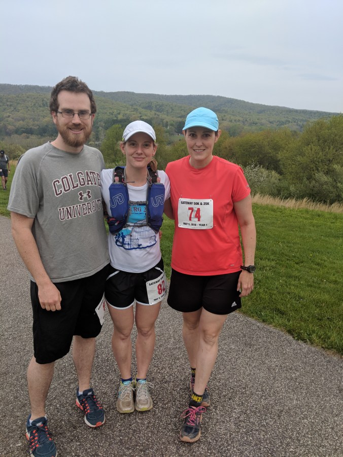
Friends and I pre-race with scenic valleys and ridges in the background near Blacksburg, VA
A couple of days after the race, I spent a half-day with my husband near Floyd, VA. We drove to the Blue Ridge Parkway to do a trail run and then enjoyed some wine at Chateau Morrisette, which is nearby. The Blue Ridge Parkway is a road that runs through another physiographic province (can you guess which one? Correct, the Blue Ridge!). As in the Valley and Ridge province, the rocks that make up this province were exposed during Appalachian mountain building: they were deformed and transported along faults. The rock types that make up this province; however, are different from those rocks that make up the Valley and Ridge. Exposed along the Blue Ridge are “basement rocks” that have deeper, more “complex” origins: they show evidence of an even older period of mountain building that happened prior to the formation of the Appalachians. This “basement-involved” process exposed older metamorphosed volcanic and sedimentary rocks that erode differently than those in the Valley and Ridge and therefore result in different topography.
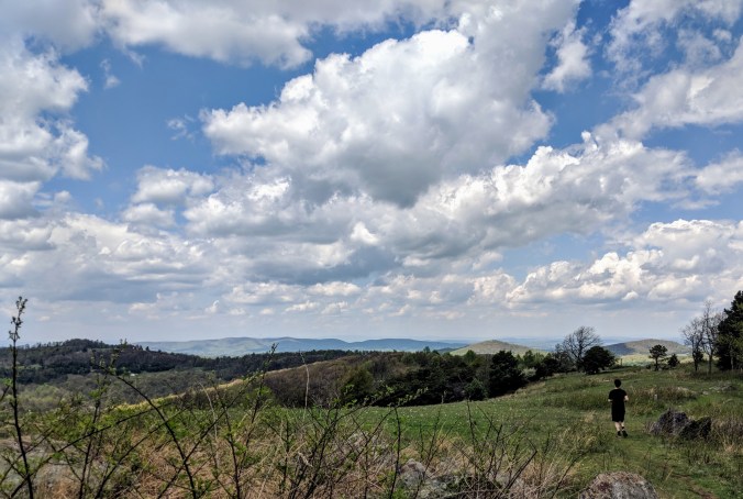
Running along the Blue Ridge Parkway: views to the west show the nearby Valley and Ridge province.
This topography – which has been evolving over several millions of years – creates breathtaking views that make running along trails and relaxing with a glass of local wine one of the most pleasant experiences!
There’s plenty more Virginia travel and geology to discuss in my next post: Virginia is for (province) lovers: Part II. Stay tuned!


