Death Valley does not sound like the name of a place I would want to venture into and yet it’s a place I’ve come to treasure. Death Valley, in eastern California is advertised as the “hottest, driest, and lowest” of the National Parks. It sits in the Mojave Desert and is a valley with mountain ranges on all sides. For example, on the west side there is the Panamint Range and on the east side there is the Amargosa Range.
Death Valley is interesting – geologically – because it is affected by a lot of different tectonic “regimes”. It is dynamically situated at the confluence of the Eastern California Shear Zone (which is associated with the Pacific-North America plate boundary); the Sierra Nevada (large suite of intrusive igneous rock that was subsequently uplifted and tilted); and the Basin and Range (extensional tectonic province spanning western North America).
I last visited Death Valley earlier this year – my brother is living in California and he was taking his first geology class. His school was also offering a field trip to Death Valley over Spring Break and my brother was so interested in his introductory geology course that he decided to attend the field trip, and he invited me!
I drove for a very long time to get there from my home near Phoenix. Arriving after dark, the course participants were all cleaning up following dinner so I set up my tent at the campground and hung out with my brother for a bit before going to sleep.
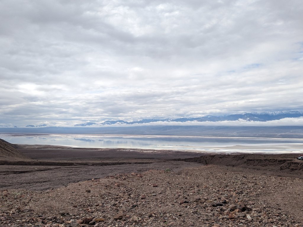
The next day we decided to explore on our own due to the fact that there were some places we wanted to check out that the course instructors weren’t planning to visit. The weather was also not great – it was actually quite rainy so the “driest” National Park was actually pretty wet. The valley was even filled with water – forming the now ephemeral Lake Manly (a rare occurrence). This was a remnant of the atmospheric river that affected southern California in the early months of 2024.
We had quite the adventure, and saw a TON of lovely geology, which I hope to share more about with you in some subsequent posts. For now I’ll just talk about our first stop, which consisted of a visit to Badwater Basin (and Lake Manly which filled it).
It was my second time at Badwater Basin. The first time I visited was in early March 2020 shortly before the onset of the COVID-19 pandemic. It was actually the last traveling I did prior to everything pretty much shutting down. I was working on a project in the Panamint Mountains that was fully remote so I wanted to visit in-person and get a better sense the geology. I went through Death Valley to get there and stopped at Badwater Basin along the way.
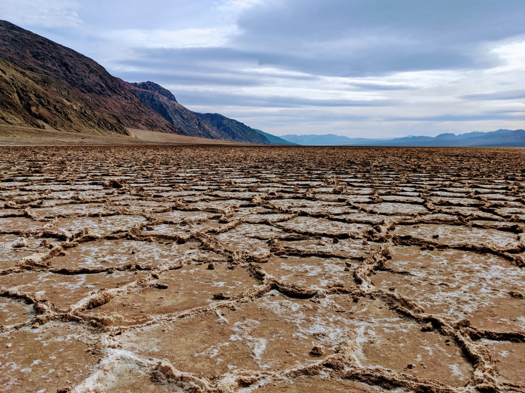
Badwater Basin is considered the lowest point in North America. Although, I met one geologist that argued against this – actually, a very important geologist – David Applegate, the incumbent director of the US Geological Survey. Anyway, the Basin reaches all the way down to 282 feet (85.5 meters) below mean sea level. It is a salt flat comprised mostly of sodium chloride (standard table salt) but also includes other evaporites (or sediments that form from evaporated solutions of water and dissolvable minerals).
The action of this hydration and evaporation of salts generates interesting polygonal geometries that are similar to cracks that form in a layer of dried out mud, for example. These cracks are very interesting in that their form (shape and size) are variable and dependent on things like the swell and shrink potential of the material (how much water it can hold), the rate of evaporation, and the temperature of evaporation.
Anyway, all of this makes for a very beautiful landscape when the ground is dried out. Of course, it wasn’t the second time I was there. The landscape was beautiful in a different way though – the flat, fairly still water reflected the surroundings like a foggy mirror. Simply surreal.