This past Saturday I joined my colleague Callan Bentley and the Piedmont Virginia Community College Geology Club for the second day of their two-day field excursion. The trip traced the Massanutten synclinorium and the deformed Valley and Ridge sedimentary rocks exposed along Corridor H in West Virginia. It was also my first time taking my own students into the field as a geology professor at NOVA. I brought two of my Historical Geology students, and I think it was a meaningful day for them.
We met at the McDonald’s in Strasburg, VA. I arrived half an hour early to get organized, and I handed each of my students a fresh field notebook for their first outing with me. One of them left his in the car and took no notes at all, but that’s beside the point.
I’ve been adapting Callan’s slides for my Historical Geology course this semester, and one of my students took the chance to ask him about a mystery: why is there a picture of a cat shedding fur in the slides? I’d wondered the same thing. It turns out the cat stands for an actively eroding mountain belt (an orogen) shedding sediment into the surrounding basins. Mystery solved, and now I’ll never unsee it.
From Strasburg it’s about 30 minutes to the first outcrop on Corridor H. Callan calls it “the superhighway to nowhere,” and that’s exactly what makes it such a spectacular place to study Appalachian mountain-building. The highway connects a few small communities in West Virginia, so traffic is light, and the enormous roadcuts are relatively safe to explore. We still wore hard hats and high-visibility vests. Every so often a passing driver honked at us, which we always chose to interpret as friendliness.
Our first stop was the Tuscarora Sandstone, a very pure quartz arenite, meaning it is almost entirely quartz. That purity tells you the sediment was extremely mature. It was weathered, transported and reworked long enough that nearly everything except quartz had been broken down or winnowed away. I contrast this in class with “dirtier” sandstones. Arkose keeps lots of feldspar because it came from a nearby, quickly eroded source. Greywacke is a muddy, poorly sorted sandstone typically dumped by turbidity currents. Both are good examples of how source area and transport conditions shape the rock you end up with.
Standing at that outcrop, I thought about how Callan had introduced himself to my students. He’s been teaching geology for over 20 years and leading trips to Corridor H for about 12. If teachers were sandstones, Callan would be well on his way to a quartz arenite: years of reworking lectures and assessments, with the examples that don’t work winnowed out. I’m still a little immature by comparison. But I’m working on it.
There at that first outcrop, students practiced reading depositional energy from grain size. The general rule is that larger grains mean higher-energy settings, because it takes a faster-moving current to keep big grains in transport.
At the next stop we encountered the Tonoloway Limestone, and one of my students found a breccia packed with mud rip-up clasts. These are chunks of muddy sediment that a storm tore up and redeposited, possibly a hurricane sweeping across a Silurian tidal flat. We had gone over this in class during our sedimentary processes unit, and I was pleased that my student was able to make the connection.
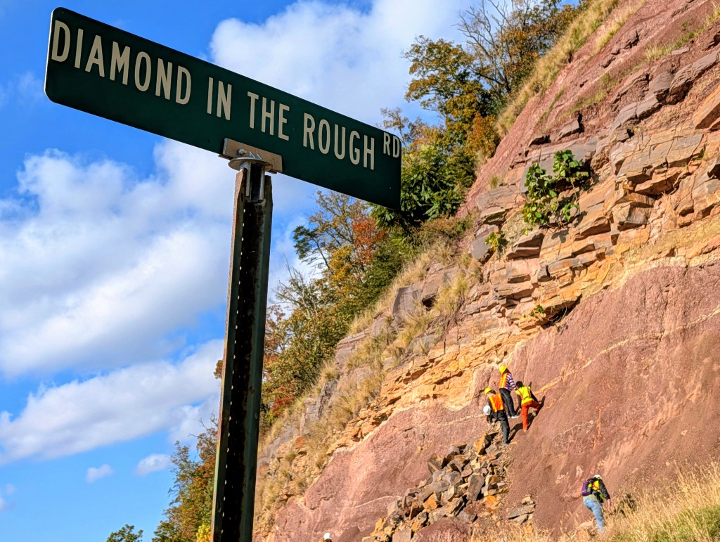
Then we hunted for fossils in the Hampshire Formation along Diamond in the Rough Rd. Students climbed precariously up the outcrop, making me a little nervous, but apparently that’s what it takes to find the best fossils.
We made a few more stops, but my favorite by far was what Callan calls the MTD, a mass transport deposit, with a diamictite beneath it. The MTD formed during a massive, high-energy submarine landslide that dumped sand on top of soft, water-saturated mud. The weight of the sand deformed the mud beneath it, producing soft-sediment deformation features called ball-and-pillow and flame structures. The result looks like a campfire frozen in rock: rounded blocks of sandstone (the “balls”) sank down into the mud, while the mud squeezed upward between them in pointed tongues that lick around the blocks like flames.
This stop had history for me. About 11 or 12 years ago, as a student on one of Callan’s trips, I was the one who first found the diamictite at this location, and of course Callan told the story to all the students. But despite being able to identify the diamictite, back then I had somewhat little idea what I was looking at when I saw the MTD. When I was asked to sketch the outcrop, even that felt overwhelming. I could make observations, but sketching is an interpretive act, and I didn’t yet have the geological context to know what deserved a place in my notebook.
Right: Evelyn poses in front of the MTD.
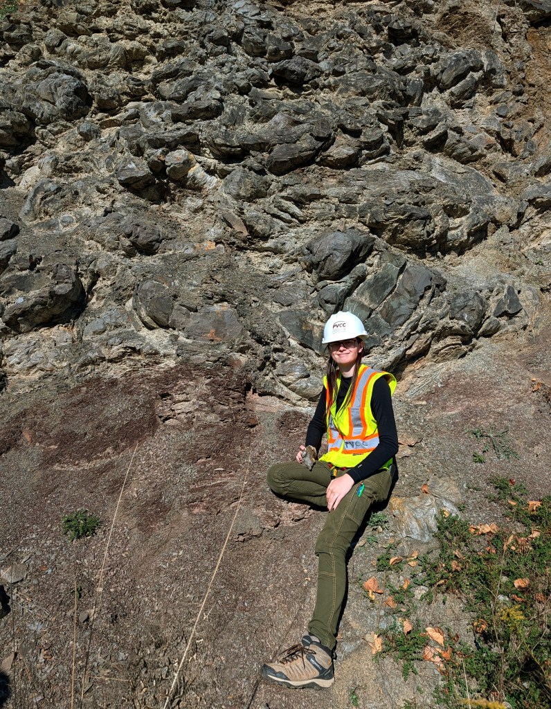
This time, I sketched the outcrop again, and in the act of drawing it, the processes behind the deposit came together for me in a way they never had before. It was the highlight of the trip for me geologically. But the real moment was standing there, in my first year as a full-time professor, listening to Callan tell a new group of students about my discovery from 12 years ago.
So much of my time at NOVA has felt full circle. I’m teaching the classes I once took. I find photos of my student self in the prep room and on the bulletin boards. And now I’ve returned to Corridor H with a PhD and a much deeper understanding of how these rocks came to be.
I’m not a quartz arenite yet. But I am maturing.

